Other Hiking and
Backpacking Excursions
Idaho
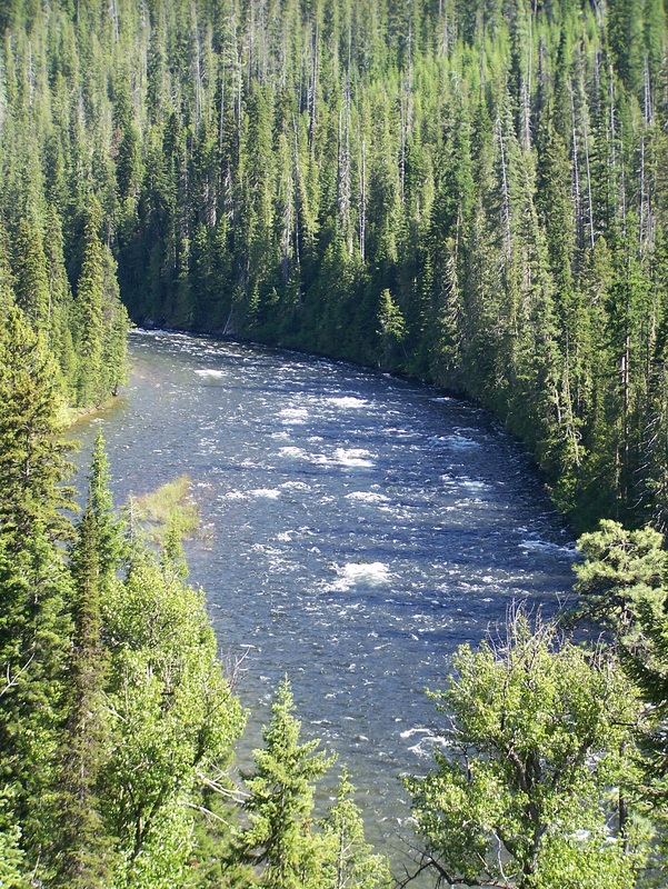
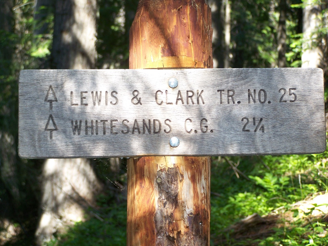
Lewis and Clark Trail #25: This was an easy 4.5 mile hike that I took from White Sands Campground. There are several different sections of the Lewis and Clark Trail that all follow along closely to the route that Lewis and Clark actually took in the early 19th century. Being related to Meriwether Lewis makes it that much more fun to retrace part of the original route. This particular section is near Lolo Pass in Idaho. From the White Sands Camp ground you gradually climb to the top of a ridge where it then levels off and, for the most part, parallels the Lochsa River. Most of the trail is through pretty dense vegetation. There is a lot of canopy cover for shade which also keeps the soil damp and allows plants such as ferns to grow. I only went 2.25 miles down the trail to the next road and turned back. I would have loved to go further, but I didn't have the time. There is a lot of wildlife in the area. I saw three deer on the hike, and have also seen bald eagles and moose nearby.
Rating: 8/10
Rating: 8/10
Nevada
Wheeler Peak and Rock Glacier: This was an awesome little hike in Great Basin National Park in Eastern Nevada. The hike starts out moderate but becomes difficult after about 2 miles. The side trail that eventually leads to Rock Glacier is moderate. Overall, this hike was about 13 miles. Part of the difficulty of this hike is just in the elevation. The trailhead starts above 10,000' and climbs to the top of the only glaciated peak, and the 2nd highest peak in Nevada. Once you get to the ridgeline on your ascent, things become more difficult. The trail then becomes steeper and you also have the wind to deal with. To the west, there is a valley about 4,000 feet below that is filled with windmills. If they're getting significant wind down below, you imagine what the wind must be like on the mountain. This was the 2nd windiest mountain I've ever been on, behind Mt. Shasta in California. I estimate wind gusts on this hike were near 80 mph. The trail switches back and forth from the east side to the west side of the ridge. On the east side of the ridge I was able to avoid most of the wind. At the summit there are a few windbreaks made from stacked rocks which make for a nice place to relax, enjoy the view, and have a bite to eat. If you continue about 60 yards past the windbreaks you come to the South East part of the mountain that has been carved out by glaciers. About 2,300 feet below lies Rock Glacier.
When descending the mountain, there is trail off to the right after you get a little ways below the ridgeline. This trail will take you by Stella and Teresa Lakes, and a Bristle Cone Pine grove, on the way to the foot of Rock Glacier. Rock Glacier isn't very big anymore, but you can certainly see the role it has played on this mountain, which makes this part of the hike so impressive. The video below contains picture from this hike.
Rating: 9/10
Baker Lake and Johnson Lake Loop: This is a moderate to strenuous 15 mile loop inside Great Basin National Park. From the trailhead, the trail follows along Baker Creek all the way to Baker Lake. Along the way, the trail goes along the edge of some meadows where you have excellent views of the surrounding mountains. The creek running alongside the trail make the hike very peaceful. Most of the trail is a gradual climb, but there are a few areas where the trail becomes more steep. After about 6.5 miles you make it to Baker Lake. The lake itself isn't too impressive looking and appears pretty shallow, but the backdrop to the lake is stunning. From Baker Lake it is really an off-trail hike to Johnson Lake even though some maps show a primitive trail. Nonetheless, it is pretty easy to determine the direction you need to go as you climb a gradual sloping, open ravine. At the top, you can look down the other side and see Johnson Lake. From this point, there are several primitive trails down to Johnson Lake, but they are all steep and loose, so proceed with caution. After descending most of the way to the lake, you start to come across some old mining relics. Just beyond the mining relics is the lake shore. The Lake is beautiful and looks to be quite a bit deeper than Baker Lake. Just below the lake there are several old mining cabins. Going further down the trail you eventually come across the remains of an old mill. Beyond the mill, the trail continues and will again skirt several meadows, offering up the stunning mountain views. There are a few small ridges that the trail crosses over. Eventually, the trail will come to the South Fork of Baker Creek and will follow the creek back to the trailhead. Pictures from this hike can be found in the video above.
Rating: 9/10
Rating: 9/10
